Okay it's the first day of the new year & I am determined to start it out right.... Go with the husband & the dog on a long hike. Since it was cold that day we were looking for a sunny hike. Zuma Ridge Trail is a beautiful panoramic trip on the top of the mountains overlooking the pacific.
The Trail starts out at the base of a flood plain and proceeds to a gradual climb upward.
The Trail starts out at the base of a flood plain and proceeds to a gradual climb upward.
 | |
| Take Bush drive off of Pacific Coast Highway up to the parking area. See above "Zuma Ridge Trail". | Map Courtesy of the Park Service. |
Parking lot & Trail Head
Gradual climb
Panoramic View at the top. You can see Bony Ridge in the distance.
The entire hike took us 2.5 hours.
It is 2.7 miles (and 1500 feet of elevation gain)
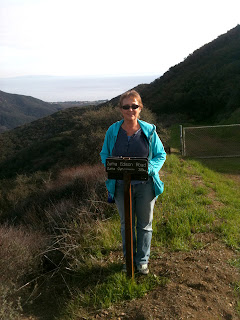
Here is the sign at the top.
We made it.... Next time we are going to continue the hike to Encinal Canyon Road.
Gradual climb
Panoramic View at the top. You can see Bony Ridge in the distance.
The entire hike took us 2.5 hours.
It is 2.7 miles (and 1500 feet of elevation gain)
Here is the sign at the top.
We made it.... Next time we are going to continue the hike to Encinal Canyon Road.


No comments:
Post a Comment